Thermal Features
Tuesday, July 12, 2005: I checked out of Mammoth at about 6:30 and headed toward Norris. My first real stop was at Swan Lake, prompted by the two white specks I noticed while driving. The binoculars resolved them into swans, and the scope revealed they were the expected Trumpter Swans. Some ducks were also present. A succession of stops followed as I traveled through Willow Flats. It was fairly birdy there and it took me until after 9 to travel the 20 miles to Norris.
 |
 |
 |
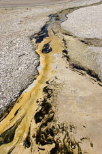
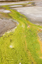
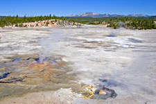
| Outflow Streams at Norris | Puff 'n' Stuff Geyser | |
|---|---|---|
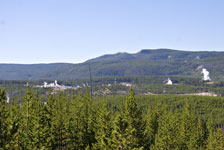
I find Norris Geyser Basin an interesting place, particularly for the colors that the various thermal features (and the organisms that live there) create. In many ways, I prefer the Porcelain Basin to the Back Basin because of this. The major geysers (Steamboat, Echinus) are in the Back Basin. Neither of them geysers erupted while I was there (Steamboat has apparently had a number of minor, 30 foot eruptions lately). I was surprised they didn't have a prediction for when Echinus would erupt. Three years ago they did, and it was reasonably accurate. Apparently Echinus is no longer predictable.
 |
 |
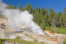 |
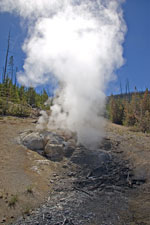
| Norris Geyser Basin | Porcelain Basin | Black Growler Steam Vent |
|---|---|---|
 |
 |
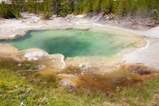 |
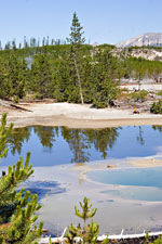
| Back Basin View | Echinus Geyser | Emerald Pool |
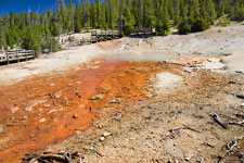
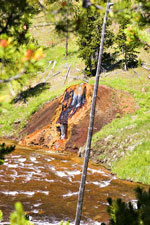
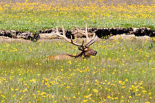
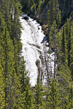
Chocolate Pot & Virginia Cascade
I tried to go to Artist's Paint Pots next, but the parking lot was full so I skipped it for now. I did see one of the “chocolate paint pots” along the Gibbon River. I also stopped by Gibbon Meadows, where I found some Elk. Virginia Cascade Road is a two-mile, narrow, one-way road along the Gibbon River featuring some precipitous dropoffs. It's hard to believe it was once the main road! It features the 60-ft. Virginia Cascade.
 |
 |
 |
| Chocolate Pot | Elk! | Virginia Cascade |
|---|
I tried to go to Little Gibbon Falls. The trailhead is not marked, but I had directions telling me to go to a particular unmarked turnout east of the Ice Lake trailhead, then walk about 100 feet east where there may be a red marker. There wasn't a marker, but there was a trail. Following it into the woods, I found a sign giving the distance to the next trail intersection. Success! However, about 0.4 mile in the trail crossed a wet meadow, with standing water. I didn't have proper footgear, so I turned back rather than soak my tennis shoes. Guess I should have worn boots!
Arrival at Canyon
I ate lunch around 2, reacquainted myself with Canyon Village (they are putting in a new visitor's center and then checked in. Some things are still the same. I noticed a buffalo grazing next to a cabin across the street, just as last time.
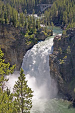
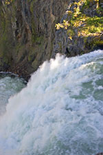
Upper Falls of the Yellowstone
By the time I was set to go out again, it was around 4. I viewed the Upper Falls from the South Rim of the canyon, then walked upriver for a little bit. At one overlook, there was a pair of Peregrines overhead, followed by a Swainson's Hawk.
 |
 |
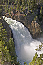 |
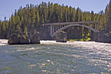
| Upper Falls of the Yellowstone |
Yellowstone River and Canyon Bridge |
Upper Falls of the Yellowstone |
|---|
I planned to end my day's activities by visiting the Hayden Valley for a while. Lots of buffalo, a few elk, a lot of Canada Geese and some other birds. No luck on grizz or wolf. Since I was returning early, I made a stop at the Brink of the Upper Falls before dinner. After dinner, I went to the evening program, which was about hiking in Yellowstone.
 |
 |
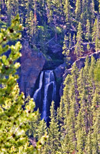
| Crystal Falls | Brink of the Upper Falls |
|---|
Birds: 141. Mammals: 24.
Canyon, WY